Should we build a bridge across Knik Arm?
It's baa--aak!
Maps: Click on the images to view them full size in a new window.
Jump to: Area and Alternatives | Travel Time | Belugas | Pt. MacKenzie Land Ownership
Travel Time Maps
Beluga maps
Pt. MacKenzie land ownership
Jump to: Area and Alternatives | Travel Time | Belugas | Pt. MacKenzie Land Ownership
Area and alternatives maps

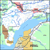
Map of the Area
JPEG Format, 1632 x 1056 pixels, 340KB
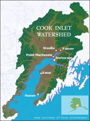
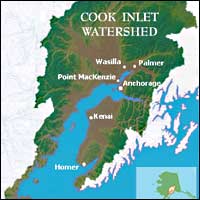
Cook Inlet Watershed Map
JPEG Format, 54KB
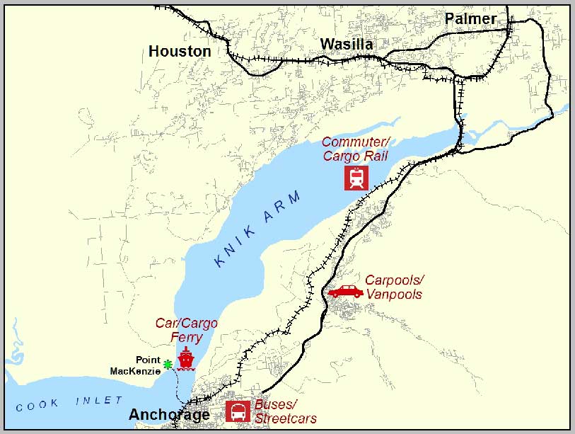
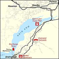
Graphic Illustrating Alternatives
JPEG Format, 72KB
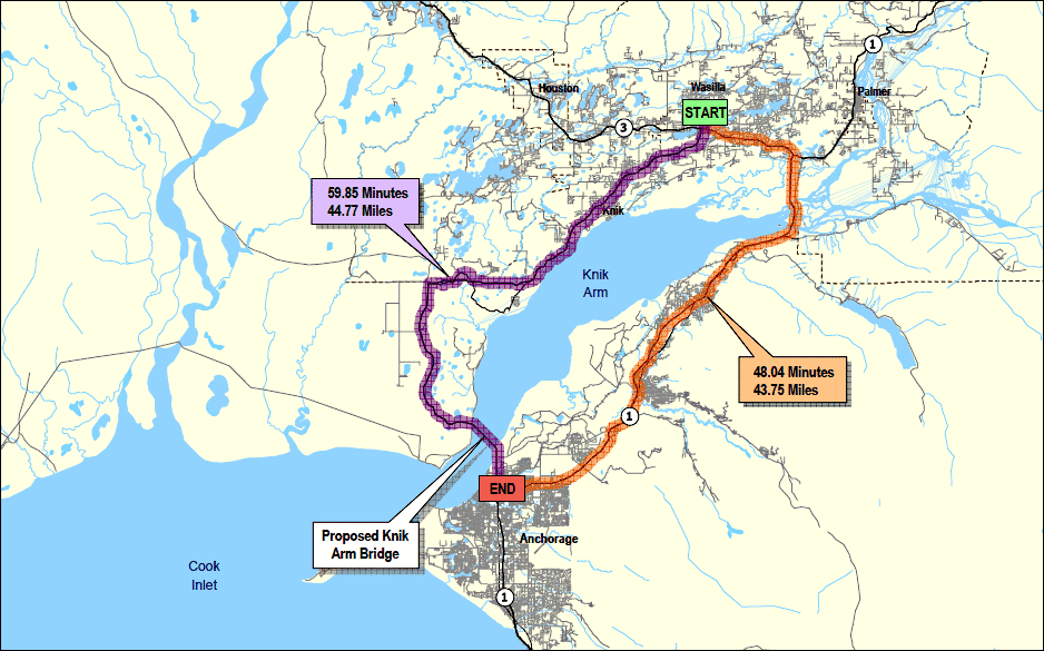
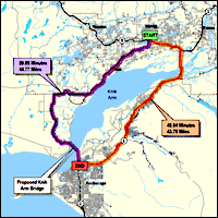
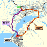
Graphic of Travel Times Comparison, Wasilla
GIF Format, 94KB
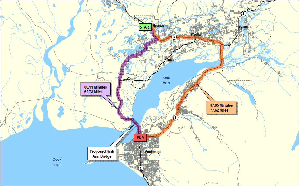
Graphic of Travel Times Comparison, Houston
GIF Format, 94KB
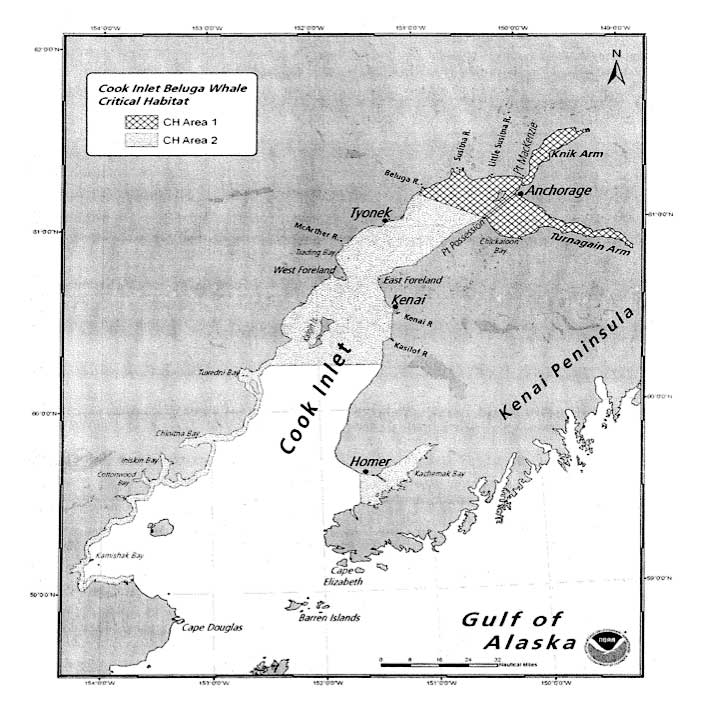
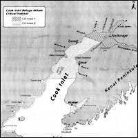
Map of Critical Beluga Habitat from NOAA
JPEG Format, 700 x 700 pixels, 69KB
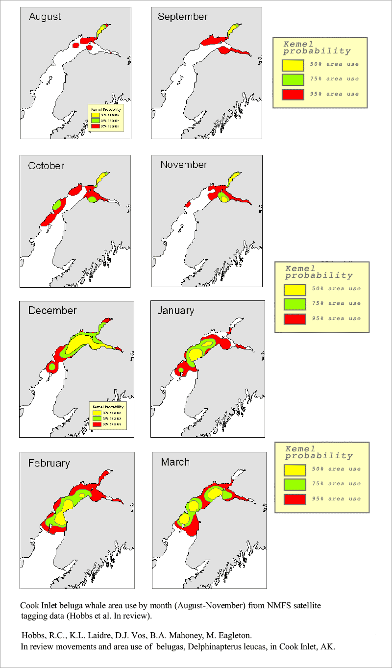
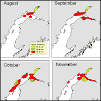
NOAA Beluga Whale Study Maps
GIF Format, 60KB
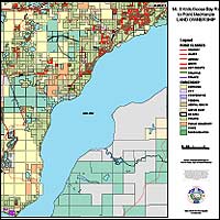
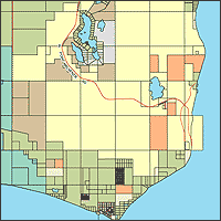
Point MacKenzie Land Ownership
PDF Format, 48 x 36 inches, 1.7 MB
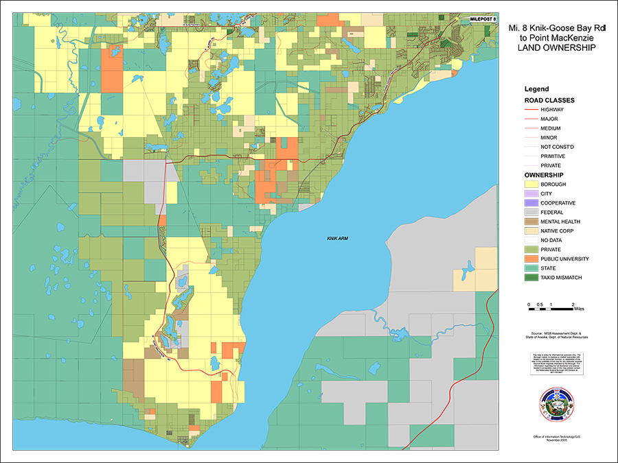
Point MacKenzie Land Ownership
JPEG Format, 900 x 675 pixels, 212 KB

Point MacKenzie Land Ownership
GIF Format, 900 x 685 pixels, 60 KB
